Mapping &
modeling
CORE FEATURES:
LiDAR Mapping
Photogrammetry Mapping
Point Cloud Modeling
Orthomosaic Modeling
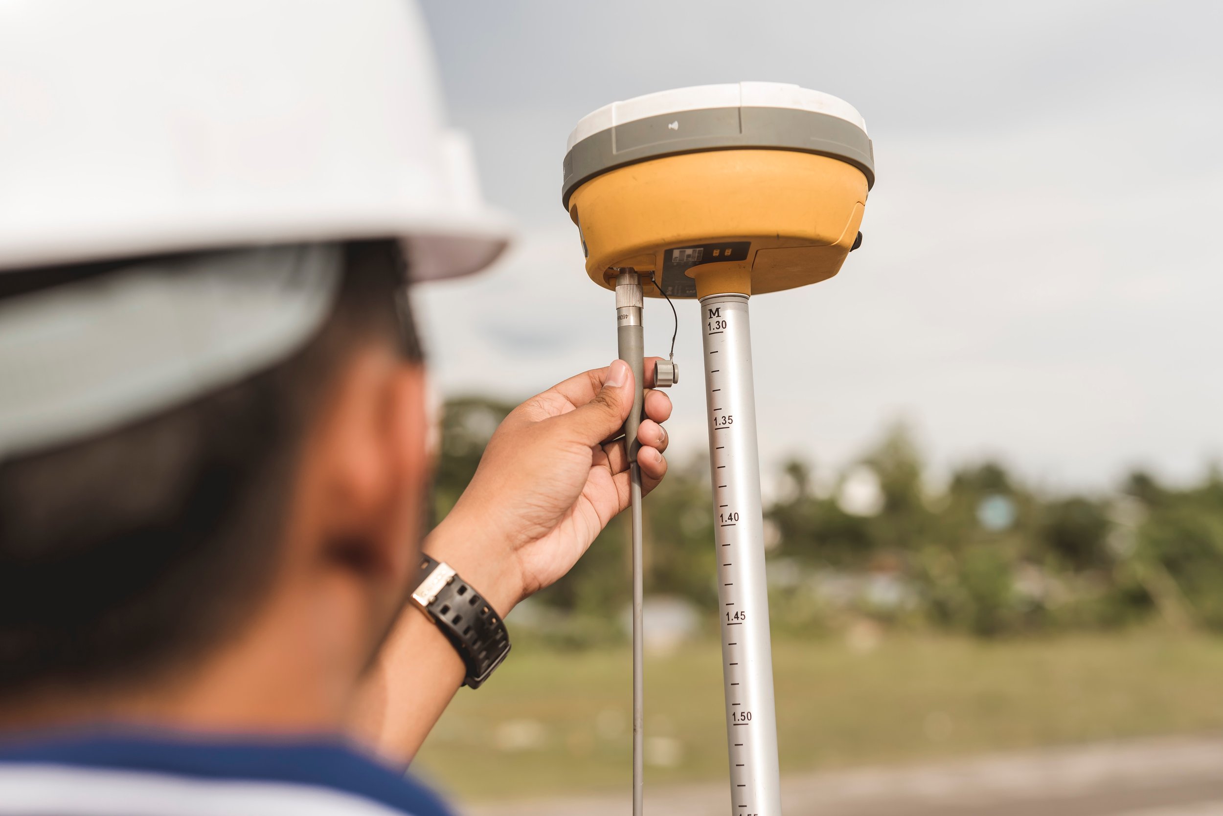
GNSS Ground Control
Explore more details about our mapping services below.
This image showcases a detailed industrial site captured using LiDAR technology, with point cloud data highlighting the intricate structures and terrain. The precision of the point cloud allows for accurate measurements and detailed analysis, enabling effective site planning, assessment, and maintenance.
-
LiDAR (Light Detection and Ranging) technology integrated with drones offers significant advantages for collecting detailed three-dimensional data across various landscapes and applications. Drones equipped with LiDAR sensors can quickly capture high-density point clouds, providing centimeter-level accuracy for mapping, terrain analysis, and infrastructure inspections. This precision is invaluable in industries like construction, land surveying, and environmental monitoring, where accurate data is crucial for effective decision-making.
The use of drones for LiDAR data collection allows for rapid coverage of large areas, making operations more efficient compared to traditional methods. The data gathered can be processed to create detailed topographic maps and 3D models, enhancing planning and resource management efforts. Additionally, LiDAR-equipped drones can operate in challenging environments, delivering reliable data regardless of terrain. Overall, the integration of drones and LiDAR technology is transforming site assessments and infrastructure monitoring, improving the overall effectiveness of operations.
-
Photogrammetry is a mapping technology that utilizes aerial images captured by drones to create accurate models of landscapes and structures. By processing multiple overlapping photographs, photogrammetry software generates high-resolution orthomosaic maps with precise measurements. This method provides a live, colorized view of the surveyed area, enhancing visualization and analysis.
With drone-based photogrammetry, accuracy can reach within centimeters, making it essential for construction, land surveying, and environmental monitoring. This rapid data collection enables informed decision-making based on real-time information, improving project planning and execution while facilitating better communication among teams and stakeholders. The integration of photogrammetry with drone technology is transforming mapping and surveying tasks across various industries.
-
LAS point cloud data is essential for creating detailed 3D models of landscapes and structures. Drones equipped with LiDAR technology can capture over 600,000 data points per second, generating highly accurate point clouds. A key advantage of LiDAR is its ability to penetrate vegetation canopies, allowing software to strip away layers and reveal a bare earth surface model beneath dense tree coverage. This capability is invaluable for urban planning, construction management, and environmental assessments.
With centimeter-level accuracy, LAS point clouds enhance decision-making by providing critical insights into terrain and existing structures. Integrating LAS data with GIS systems further improves spatial analysis, transforming the mapping and modeling approach across various industries. Ultimately, utilizing LAS point cloud data through drone technology leads to greater efficiency and improved project outcomes.
-
Orthomosaic models are precise, geometrically corrected aerial images that accurately represent the Earth's surface. Created by stitching together multiple overlapping drone photographs, these models undergo advanced processing to ensure alignment and scaling, resulting in a seamless, high-resolution image.
One of the primary advantages of orthomosaic models is their centimeter-level accuracy, making them essential for land surveying, agriculture, and construction applications. They enable professionals to analyze terrain, monitor changes over time, and assess the condition of assets with exceptional detail.
Additionally, orthomosaic models provide a colorized view of the landscape, enhancing visualization for better decision-making. Their integration with Geographic Information Systems (GIS) allows users to perform spatial analyses and create layered maps that combine various data sets, ultimately improving project planning and management. Overall, orthomosaic models are a transformative tool for accurate mapping and analysis in multiple industries.
-
Ground control is essential for enhancing the accuracy of both LiDAR and photogrammetry applications. By utilizing high-precision GNSS modules and strategically placed ground control points throughout the survey area, operators can achieve remarkable spatial accuracy and data reliability. These modules provide real-time corrections, allowing for the precise geolocation of collected data, which is critical in ensuring that the resulting models are both accurate and usable for decision-making.
Incorporating a robust ground control network allows surveyors to establish accurate reference points, facilitating the integration of data from various sources. This process ensures that both LiDAR and photogrammetry data are aligned correctly, enabling the creation of highly accurate 3D models and maps. The use of advanced GNSS technology significantly reduces positional errors and enhances the overall quality of the survey results, making it a foundational element in modern surveying practices.
This orthomosaic file may resemble a standard aerial view, but it's actually a composite of hundreds of high-resolution images, stitched together using advanced surveying software for exceptional precision. In the GeoTIFF format, you can zoom in to see details as fine as individual blades of grass, ensuring unmatched clarity for land surveying measurements and analysis.
When working with land elevations and positioning, it's essential to use GNSS positioning data and ground targets to correct the data, ensuring the highest level of accuracy for precise results.


